

With its ancient wonders and mystical landscapes, Egypt is a treasure trove of geographical marvels that have captivated explorers and historians for centuries. From the mighty Nile River to the vast Sahara Desert, the geography of Egypt is inextricably intertwined with its storied history and eclectic culture. Read on for a journey through time and terrain as we unravel the enigmatic geography of Egypt.
Overview
Egypt sits in northern Africa, bordering the Gaza Strip, Israel, Libya and Sudan, with its boundaries also encompassing the Sinai Peninsula. Egypt’s topography consists mainly of desert plateau, although the eastern part is cut by the Nile River Valley. The country’s highest point is Mount Catherine at 8,625ft, while its lowest point is the Qattara Depression at -436ft. Egypt is the 30th largest country in the world, with a total area of 386,662 square miles, and the climate consists of hot, dry summers and mild winters. Cairo, the capital, has an average July high temperature of 35°C and an average January low of 9°C.
The Nile River: Egypt’s Lifeline
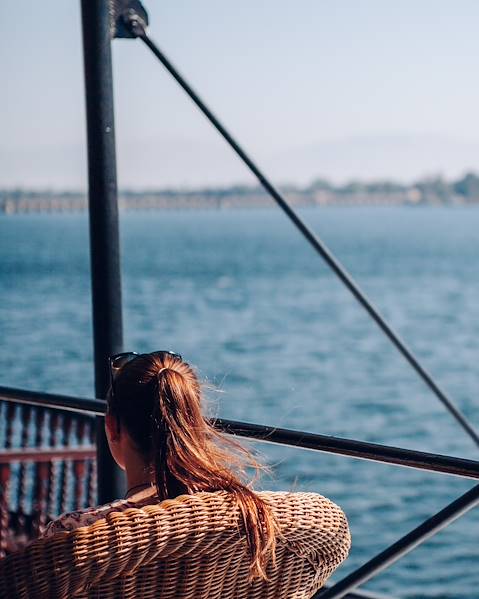
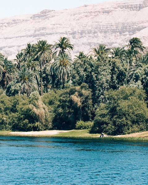
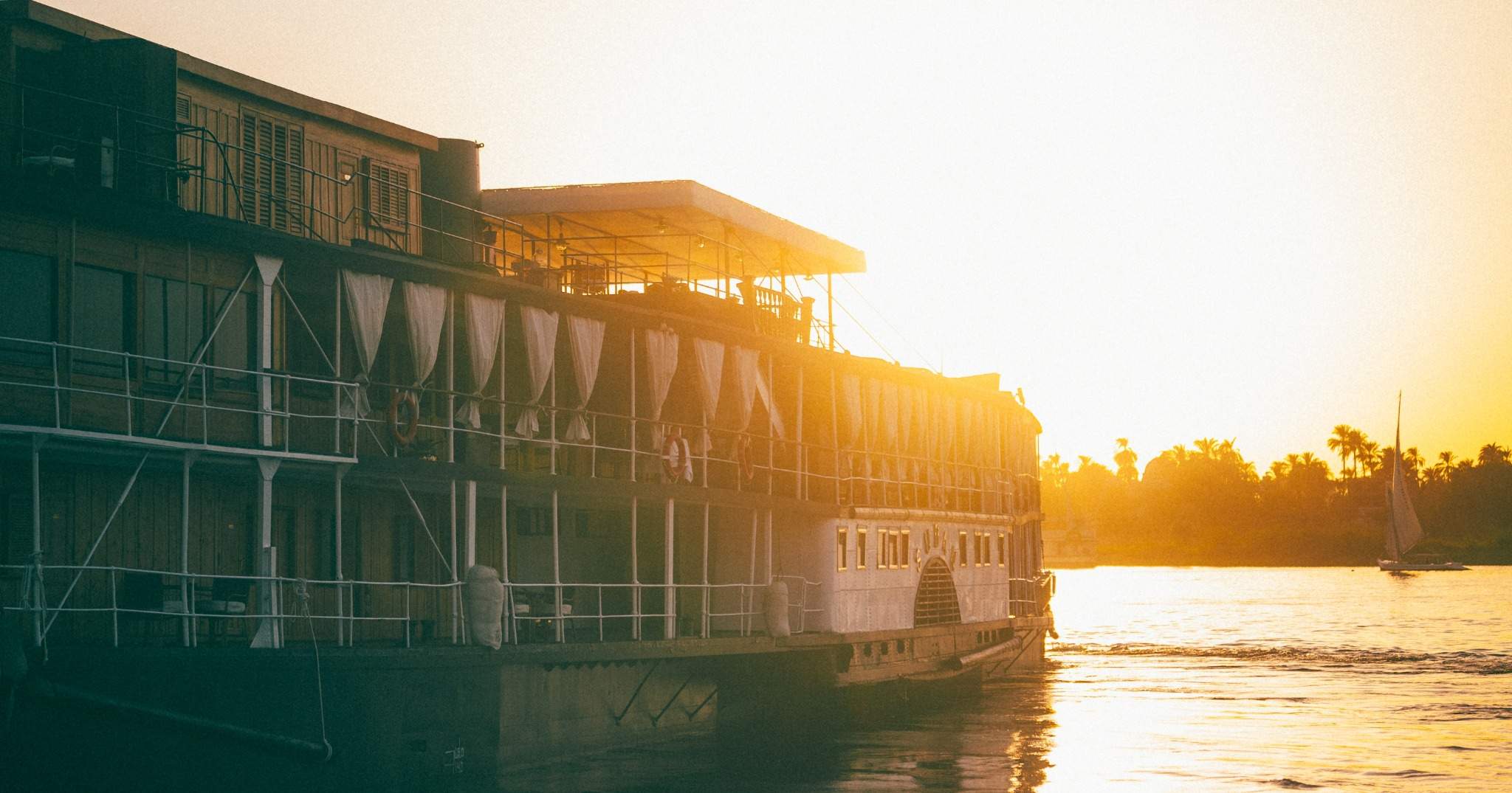
The Nile, the world’s longest river, is the beating heart of Egypt. So much so that it has shaped the country’s geography, culture and civilisation for thousands of years. The Nile is formed by the confluence of the White Nile, originating from Lake Victoria in East Africa, and the Blue Nile, originating from Lake Tana in Ethiopia. These two tributaries merge near Sudan’s capital, Khartoum, before flowing northward through Egypt. As the Nile reaches Egypt, it fans out into a vast delta, creating a fertile region known as the Nile Delta. Thanks to its rich soil, this area has been the breadbasket of Egypt since ancient times. Stretching south from the Nile Delta, the Nile Valley is a narrow strip of land flanked by desert on both sides; seasonal flooding deposits rich sediment throughout the valley, while the water of the Nile provides moisture for plant life. Hence, this region has long been the cradle of Egyptian civilisation, with ancient cities like Luxor and Aswan dotted along its banks.
Egypt’s Deserts: Seas of Sand
Ancient Egyptians divided the country into two zones: the ‘black land’ and the ‘red land’. The black land was the fertile territory on the banks of the Nile, while the ‘red land’ was the barren desert that protected Egypt on two sides. Indeed, more than 90% of Egypt consists of desert areas, the two biggest being the Western Desert, a part of the Sahara Desert, and the Eastern Desert. The Western Desert covers two-thirds of the country to the west of the Nile River and is home to the Jilf al Kabir Plateau and the Qattara Depression (which has the lowest elevation in Egypt). It also features stunning landscapes, such as the White Desert with its surreal white rock formations, and the Great Sand Sea, where towering sand dunes stretch as far as the eye can see. The Eastern Desert is approximately one-third of the Western Desert's size and sits east of the Nile River. It differs from the Western Desert due to having mountainous terrain, rather than a plateau and series of depressions, with its main mountain range belonging to a chain named the Red Sea Hills. For generations, travellers have been lured by the beauty and mesmerising stillness of Egypt’s deserts, leaving behind the comfort of what is familiar in a quest for adventure, knowledge and escape.
Oases: Hidden Treasures of the Desert
Nestled among the vast deserts of Egypt are hidden oases; lush pockets of greenery that provide a stark contrast to the surrounding arid landscapes. Located in the Western Desert, Siwa Oasis is a remote and enchanting oasis known for its natural springs, ancient ruins and fascinating Berber culture. It offers a tranquil retreat for those seeking a break from the bustling cities. In the Western Desert, Bahariya Oasis is famous for its hot springs, palm groves and the nearby White Desert. It’s a popular destination for desert safaris and adventure seekers. Farafra Oasis, also in the Western Desert, is the smallest and most isolated of Egypt’s oases. It features surreal landscapes, including the Black Desert and the Crystal Mountain, which make it a photographer’s paradise.
The Sinai Peninsula: A Bridge Between Two Continents
The Sinai Peninsula is a triangular landmass bordered by the Mediterranean Sea to the north. The peninsula sits at the northern end of the Red Sea, with two branches of the sea forming the peninsula's eastern and western borders. Set between the Gulf of Suez and the Gulf of Aqaba, the Sinai Peninsula is a land of dramatic peaks, including the iconic Mount Sinai. It’s also home to the stunning coastal resorts of Sharm El Sheikh and Dahab. The Sinai Peninsula is the only part of Egypt on the Asian continent, while the rest of the country is on the African continent.
The Red Sea and Mediterranean Coast: Beachfront Beauty
The geography of Egypt isn’t all deserts and rivers, and the country also boasts breath-taking coastlines along the Red Sea and the Mediterranean Sea. The former is a paradise for divers and beach lovers, with its gin-clear waters and vibrant coral reefs. It’s also home to world-class resorts, such as Hurghada and Marsa Alam. Stretching across the country’s northern border, the Mediterranean Coast offers a different kind of beachside beauty. From the bustling city of Alexandria to the tranquil beaches of Marsa Matruh, this region is a popular summer destination for locals and tourists alike.
From the life-giving Nile River to the vast Sahara Desert, the geography of Egypt is a testament to the country’s resilience and adaptability. If you fancy following in the footsteps of the Ancient Egyptians, our experts are on hand to help you plan your epic adventure.