

Known for its fascinating history, ancient temples and staggeringly beautiful scenery, Cambodia features on many a bucket list. The landscape is a jewel, comprising tropical rainforest with lush highlands in both the north and south, as well as boasting a picture-perfect coastline. Home to a wealth of nature including rare and endangered species such as Indochinese tigers, Asian elephants and freshwater dolphins, read on for more details on the rich geography of Cambodia.
Overview
Located in the south-west of the Indochina peninsula, Cambodia borders Thailand to the west, Vietnam to the east, Laos to the north and the Gulf of Thailand to the south. It’s a roughly circular country covering 70,238 square miles, around half the size of Germany. Lying completely within the tropics, Cambodia is hot and humid year-round, with an average temperature of 27 degrees and the terrain consists mainly of low plains, with mountains to the south-west and north. Two principal features of the geography of Cambodia are the Mekong River, which runs from north to south, and the Tonle Sap Lake, which sits close to the famous Angkor temple complex in the north. In the south-west, the coastline is home to sizable mangrove marshes, peninsulas, sandy beaches and bays, as well as around 50 islands.
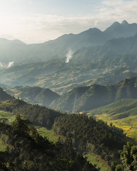
Forests and Plains
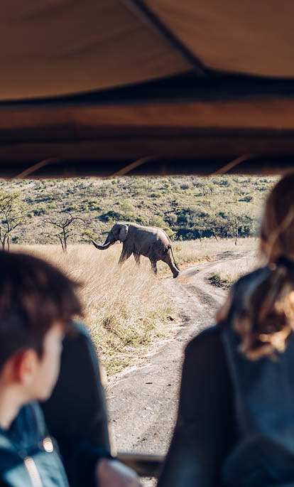
The central plains cover approximately three-quarters of Cambodia’s landmass and house the country’s mountain ranges, as well as the Mekong River and the Tonle Sap Lake. One of the curiosities of Cambodia is that it’s covered almost entirely by tropical forests, and green predominates throughout the country. The forested highlands include the Cardamom, Elephant and Dangrek Mountains as well as the Rattanakiri Plateau and the Chhlong Highlands that merge with the Central Highlands of Vietnam. Aural is the highest peak in Cambodia, sitting in the Eastern section of the Cardamom Mountains and it tops out at 5,722ft. The north-eastern forests once sheltered large populations of wild animals such as elephants, wild oxen, rhinos, and deer, but deforestation, combined with warfare and unregulated hunting, sharply reduced those numbers. Small populations of these species can still be found, along with tigers, leopards, bears and many small mammals, birds and snakes, four of which are especially dangerous.
Rivers and Waterways
The Mekong River is the largest river in Southeast Asia. Rising in the plateau of Tibet and emptying into the South China Sea, the Mekong enters Cambodia from Laos and flows southward to the border with Vietnam, over approximately 315 miles. The Mekong is connected to the Tonle Sap, a combined lake and river system of major importance to Cambodia; it’s unusual in that its flow changes direction twice a year. Tonle Sap, meaning ‘great lake’, is like a big bowl that fills with water in the wet season, when vast amounts of farmland and entire forests are submerged, and stilted houses and floating villages come into their own in the middle of the lake. When the dry season comes, the river reverses its flow back into the Mekong, leaving behind layers of fertile silt and marooning the stilted houses and floating villages on land.
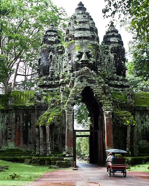
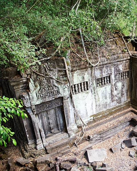
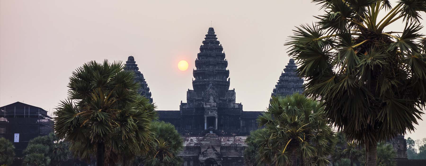
The Stone Cities of Cambodia
Brendan Borrell wrote in Archaeology Magazine: ‘Cambodia and Thailand have been colliding in one way or another since the middle of the Cretaceous period, when geologic forces thrust Thailand’s Khorat Plateau above the surrounding plains. The exposed bands of sedimentary rock here and elsewhere became the chief building material for the ancient Khmer Empire’. During the Angkor era, the Khmers used the advancing waterways of the Tonle Sap and a network of canals to transport quarried stones to temple sites, including Angkor Wat, the heart and soul of Cambodia. Almost every surface of the majestic site – the biggest religious complex on the planet – is treated with decorative details. Given the temples are largely made of sandstone, this is truly incredible. Little wonder the UNESCO World Heritage Site is top of the historic hit list for many travellers to South-east Asia.
Cambodia’s Coastline
The coastline of Cambodia extends along the north-eastern shore of the Gulf of Thailand between the Thai and Vietnamese borders for approximately 270 miles. It is shared by four provinces – Preah Sihanouk, Kep, Kampot and Koh Kong. The coast consists of estuaries, bays and more than 50 islands. Over the last two decades, infrastructure in these areas has developed and people have migrated from inland areas to coastal areas for economic opportunities. While for years Sihanoukville reigned supreme as Cambodia's prime seaside destination, other areas are becoming increasingly popular with visitors. The small coastal town of Kep is known for its blue sea crabs fried with fresh local peppercorns, while Kampot is famous for its peaceful countryside as well as nearby Bokor National Park. Visitors can also soak up the sun on Cambodia’s most beautiful islands including Koh Tonsai, Koh Russey, Koh Rong and Koh Rong Sanloem.
Whether you want to explore its picturesque peaks, lush rainforest, awesome Angkor Wat or sun-drenched islands, the unique geography of Cambodia is key to its appeal. Our expert advisers are on hand to make your trip to the Kingdom of Wonder a reality.