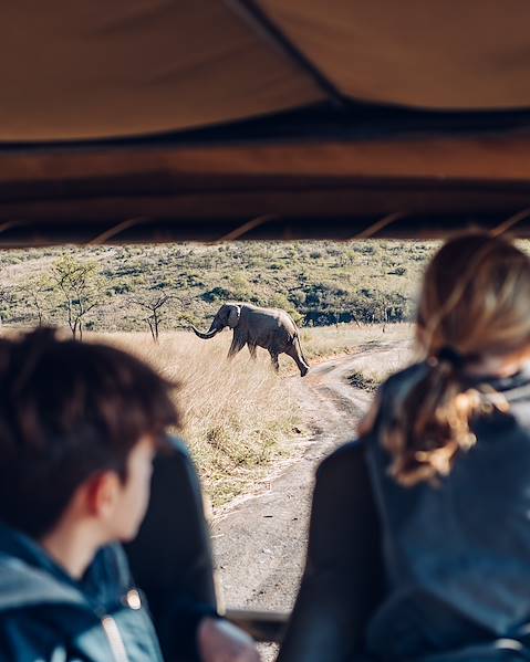

From the world’s largest inland delta and the vast Central Kalahari Game Reserve to the surreal solitude of the Makgadikgadi Pans and the abundant wildlife of Chobe National Park, the geography of Botswana is rare and wide ranging. The varied landscapes invite exploration by 4x4, horseback or quad bike, and even on foot or in a mokoro dugout canoe. Lucky visitors can even explore the incredible geography of Botswana accompanied by Kalahari Bushmen whose ancestry can be traced back more than 20,000 years. Read on to learn all about this spectacular African dream, where wildlife reigns supreme.
Overview
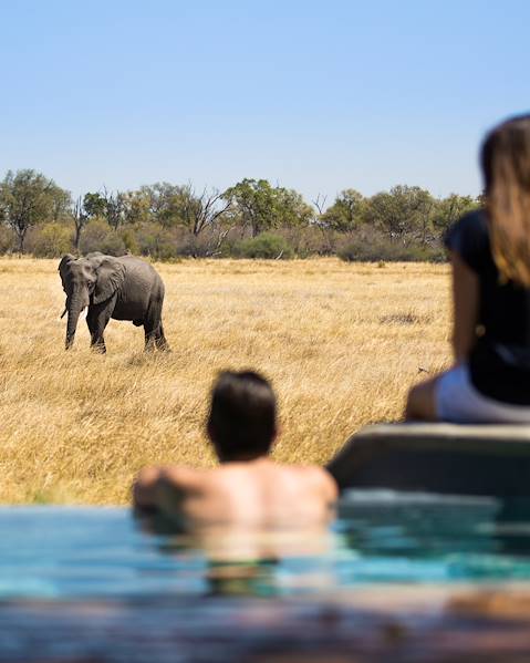
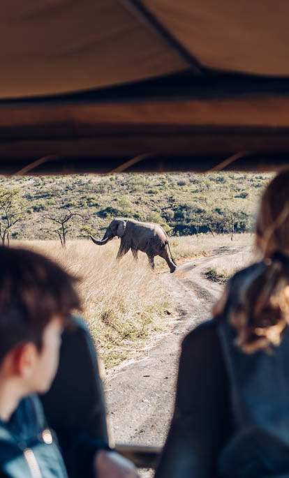
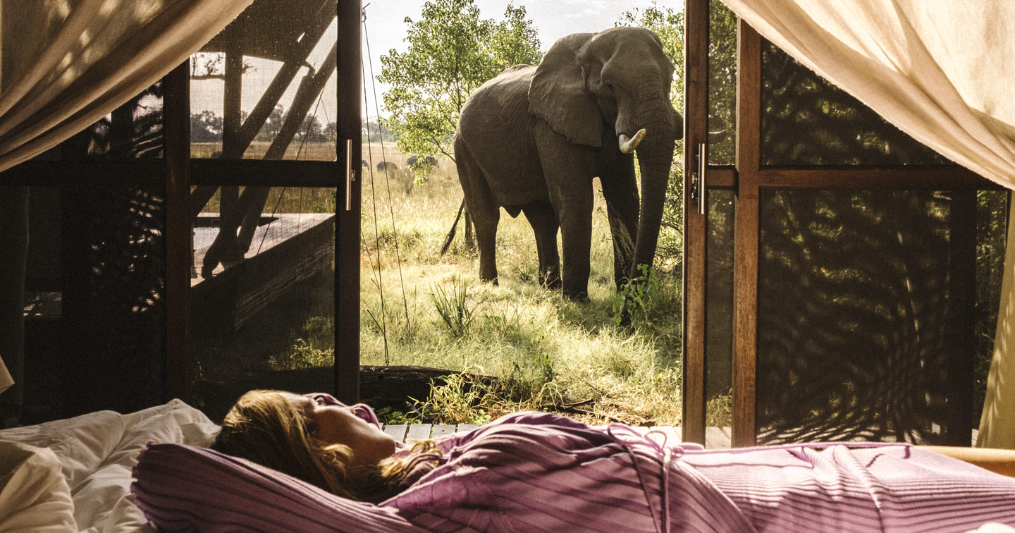
Botswana is a landlocked country in the south of Africa. Roughly the size of France, it is surrounded by four countries - Namibia to the west and north, South Africa to the south and Zimbabwe to the east, plus it shares a tiny section of its borders (about 156 metres or 171 yards) with Zambia in the north-east. The capital is Gaborone, and other principal cities include Molepolole, Kasane, Maun, Francistown, Selebi-Phikwe, Serowe, Ghanzi and Mamuno. Botswana’s very low population density allows wildlife plenty of room to flourish and its elephant population is the largest in the world. The land is also rich in natural resources, including diamonds, copper, gold, nickel and soda ash. Cattle farming and agriculture support most of the population while tourism has followed a low volume, high yield policy for years. As a result, the country boasts one of the world’s most authentic and exciting wildernesses, delivering unparalleled nature, heritage and wildlife experiences.
The Topography and Geography of Botswana
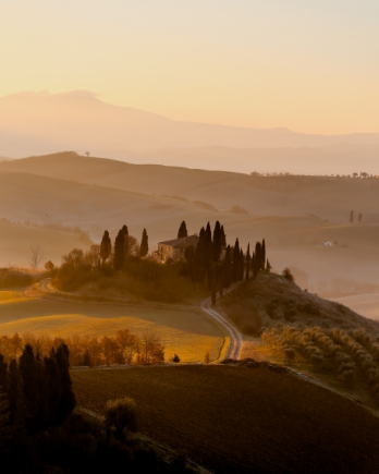
Botswana is mainly flat with a few hilly areas, and most of its highest points are located along the south-east section of the country and in the far north-west, where hills such as Aha, Tsodilo, Koinaka and Gcwihaba dot the landscape. Tsodilo Hills are a UNESCO World Heritage Site due to their outstanding rock art and tell the story of environmental changes over some 100,000 years. Botswana has four principal natural regions: the Kalahari Desert in the centre, south and west; the Okawango Delta and other wetlands to the north; the vast salt pans; and the tree savannah to the north and east.
The Kalahari Desert
Approximately 70% of Botswana is covered by the Kalahari Desert, which is a large, semi-arid sandy savannah that spans 350,000 square miles. It is considered a semi-desert as parts of it receive over 9.8 inches of rainfall annually, ensuring certain areas are well vegetated. The only truly arid portion is in the south-west which receives less than 6.9 inches of rainfall annually. The Kalahari Desert contains several popular reserves including the second largest protected area in the world, the Central Kalahari Game Reserve. It’s home to acacia trees and animals like lions, cheetahs, leopards, hyenas, antelopes and meerkats as well as many species of birds and reptiles. It’s also home to the San people who have lived and hunted on the land for thousands of years, plus the Tswana, Kgalakgadi and Herero people.
The Okavango Delta and Wetland Region
The Okavango Delta is the largest inland delta in the world and is home to all kinds of flora and fauna. Its river, the Okavango, flows in from the Angolan highlands in the north-west and soaks into the sands, creating 5,800 square miles of water channels, lagoons, swamps, and islands, increasing to 7,700 square miles during the rainy season. Moremi Game reserve is situated within the delta; it was the first reserve in Africa to be formed by residents and as the only officially protected area of the Okavango Delta, has enormous scientific, environmental and conservation significance. Other wetlands in the north of Botswana include the Linyati and the Kwando, which are sometimes called the ‘small Okavango Delta’ and boast their own vast and varied wildlife.
The Salt Pans
The Makgadikgadi and Nxai salt pans are some of the largest in the world. Part of the ancient geography of Botswana, they were formed by the evaporation of a massive inland lake, and in places the salt layers are up to five metres thick. The pans are surrounded mostly by open grassland which attracts migrating animals. Wildlife found in this area is mostly seasonal, and during the dry season the shallow pools and grassy islands are favoured by thousands of flamboyant flamingos. During and after the rains, large herds of zebras, wildebeest, impalas and springbok are found in Nxai Pan National Park.
The Tree Savannah
The tree savannah stretches from the Okavango Delta towards Botswana’s northern borders. Close to where Botswana meets three of its neighbours (Zimbabwe, Zambia and Namibia), is Chobe National Park which is where the Zambezi River crosses the Chobe River. With four distinct habitats, the park attracts unique wildlife, while the city of Kasane acts as the gateway to the national park as well as to Victoria Falls and Livingstone. At the extreme northern reaches of Botswana lie three of the country’s most splendid, wild and secluded destinations. Sandwiched between the Chobe National Park to the east and the Okavango to the south, the extensive Kwando, Selinda and Linyanti concessions offer superb wildlife viewing – and terrain to rival the physical beauty of the Okavango. This is real African big game country and during the dry season the permanent waters of both the Kwando and Linyanti Rivers serve as important migration points for wildlife from much of northern Botswana, including large herds of buffalo and elephant, wildebeest and zebra.