

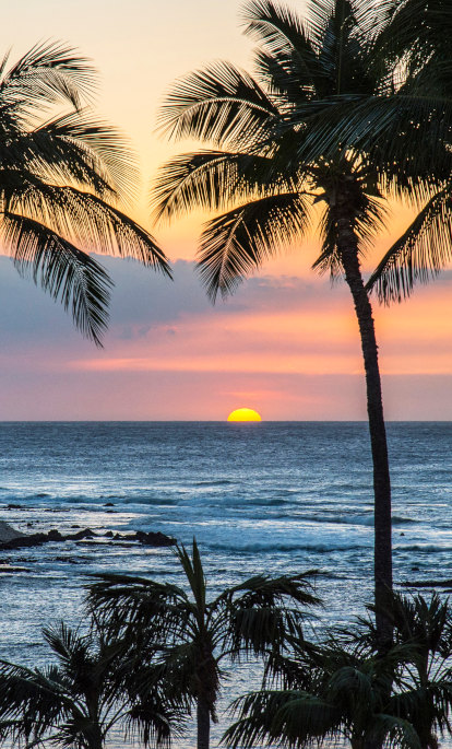


Nicaragua’s tropical climate is remarkably stable, staying hot all year round. However, there are still distinctive seasons and regional differences that it is important for any traveller to keep in mind when considering the best time to visit Nicaragua. The difference between the dry and the rainy seasons can be reasonably inferred from the names; from around January to June, the dry weather leads to yellow flora, and temperatures are very hot. From around June, the rains come to stay, with rain often falling once a day in August and September. Trees and plants blossom and turn green again, and there is an abundance of all kinds of life.
For travellers, there are benefits and downsides to both seasons. The lush landscapes of the rainy season may make up for having your days interrupted by torrential rain, especially if you consider that the rain is often dramatic enough to be a draw in itself. You could also plan your trip to correspond with turtle nesting season, which falls within these months. However, dry season comes with a reduction in the number of bugs and insects, something to consider if you want to avoid one of the few downsides (and occasionally dangers) of travelling to tropical regions. Roads are also more accessible during this period, with fewer chances of having to deal with flooding.
A major consideration also ought to be hurricanes. These storms sometimes hit the country from the Caribbean Sea to the east of Nicaragua, any time between June and November, though most often from August to October. Tropical storms from the Pacific are also likely in May, though their severity is reduced. Nevertheless, the risk of landslides and floods shouldn’t be ignored. Overall, the possibility of extreme weather in the rainy season means that, if possible, we recommend visiting in the dry season. Our list of the climate and geographical features of some of our favourite Nicaraguan regions will help you plan your trip in more detail.
León
Due to its equatorial location, the climate in Nicaragua varies mostly by altitude. León is located in Nicaragua’s Pacific lowlands, an area that extends from the Pacific Coast. The temperatures here range from highs of 33°C to lows of 22°C. León is particularly close to the highest parts of the line of hills and volcanoes (some active) covered by volcanic ash, which separate the country from the Pacific Ocean. The tourist season in León peaks around New Year, and it’s up to personal preference whether you opt to avoid the crowds or figure that they pick this time for a reason.
Granada
The oldest colonial town in Central America, the city of Granada sits on the banks of Lake Nicaragua. A historical political rival of León, it is also located in Nicaragua’s lowlands: the city, lake and the hundreds of islands (‘Isletas’) that fall into this area enjoy consistently temperate weather (by tropical standards), with an average high temperature of 34°C, and a low temperature of 30°C. The consistently warm weather means that the water is almost always perfect for swimming; the sea temperature in January is a pleasant 26.7°C, so if you visit, make sure to take advantage of the beautiful lakes in this locale. Though be careful if you are swimming in Lake Nicaragua - despite being a freshwater lake, it has bull sharks, which make their way in by jumping the San Juan River from the Caribbean Sea like salmon.
Río San Juan
A department that includes both the San Juan river and the Solentiname Islands archipelago, Río San Juan has a lot to offer to those who like to offset the hot weather with dips into the water. The department includes San Juan de Nicaragua, the wettest place in Nicaragua, with an average annual rainfall of 220 inches, so we would recommend visiting in the dry season between January and June.
Matagalpa
Located in Nicaragua’s northern highlands, Matagalpa is a mountainous department, with an average elevation of over 2,000 feet above sea level. The most diversified region in Nicaragua, Matagalpa produces coffee, cattle, vegetables, gold, flowers, tobacco and fruits and contains forests, rivers and lush geographical features that are popular among ecotourists. The rainy season is humid, and even in April, the least humid month, the average relative humidity is 69%. Temperatures range between 30°C and 34°C.
Jinotega
With a diverse array of hills and mountains, Jinotega offers both beautiful natural views and the obvious feature of somewhere known as the ‘Coffee Capital of Nicaragua’. The cloud forests of the Isabelia mountain range, high-elevation rainforests that get most of their moisture from direct contact with the clouds, are the main geographical feature of the department. The city of the same name is sometimes called ‘The City of Mist’. Other notable geographical features include the Lake Apanás Dam, which generates the department’s power, and Bosawás Biosphere Reserve, the largest biosphere reserve in Central America. The average temperature of 25°C is cool by Nicaraguan standards, and visitors are encouraged to come in the dry season, which in Jinotega falls from December to March.